HOME  »  Judith's photos » TGOC2011_Torridon_PortlethenVillage  (195 Slides)     [Page 4 of 13] :: Jump To  
P1000908 * Clan Chisholm stone.  To the West of Cannich. * 2560 x 1920 * (3.12MB)
P1000909 * Day 4. * 2560 x 1920 * (2.94MB)
P1000910 * 2560 x 1920 * (3.2MB)
P1000912 * 4000 x 3000 * (4.74MB)
P1000913 * I wish I could remember exactly where these two stones (and graves, by the look of it) are.  I think it was somewhere around NH360295 where the path goes into the woods. * 4000 x 3000 * (5.09MB)
  Clan Chisholm stone. To the West of Cannich.  
  Day 4.  
   
   
  I wish I could remember exactly where these two stones (and graves, by the look of it) are. I think it was somewhere around NH360295 where the path goes into the woods.  
P1000914 * 1920 x 2560 * (2.31MB)
P1000914_2 * 1632 x 2495 * (854KB)
P1000915 * 2560 x 1920 * (3.26MB)
P1000916 * 4000 x 3000 * (4.99MB)
P1000917 * 2560 x 1920 * (2.98MB)


P1000918 * Ha!  A Tilley Hat shadow.  This must've been the hour that the sun shone. * 2560 x 1920 * (3.01MB)
P1000919 * 2560 x 1920 * (2.88MB)
P1000920 * 2560 x 1920 * (2.96MB)
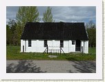
P1000921 * Corrimony church * 2560 x 1920 * (3.04MB)
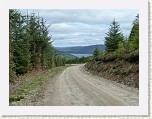
P1000922 * That's Loch Ness in the distance.  Just need to find the way down to it.  For some reason, it proved quite difficult to find a way through the woods down to Drumnadrochit.  I seemed to keep ending up heading South when I should have been going East and North.  At one point someone had scratched TGO Drum -> in the sand, so I followed that.  (I was too excited to take a photograph).  Most of the paths weren't as marked on my map.  Next year, I really must look at the Foresty Commission maps /before/ the Challenge rather than after. * 4000 x 3000 * (5.27MB)
  Ha! A Tilley Hat shadow. This must've been the hour that the sun shone.  
   
   
  Corrimony church  
  That's Loch Ness in the distance. Just need to find the way down to it. For some reason, it proved quite difficult to find a way through the woods down to Drumnadrochit. I seemed to keep ending up heading South when I should have been going East and North. At one point someone had scratched "TGO Drum ->" in the sand, so I followed that. (I was too excited to take a photograph). Most of the paths weren't as marked on my map. Next year, I really must look at the Foresty Commission maps /before/ the Challenge rather than after.  
  First page Previous page      Up one level      Next page Last page Help
Album last updated on 14/06/16 23:46
Powered by jAlbum 9 and BluPlusPlus skin
All images are mine. Please ask if you want to use them. goofif at yahoo dot co dot uk